
Twitter Feed

2018 AT&T Business Summit: Security “in” and “of” the Cloud
While public cloud is undoubtedly an outsized piece of the conversation, news headlines of the latest data breach can make this move a very frightening proposition. The question of how…

My Brush with Royalty: Queen Latifah
Queen Latifah! Hip Hop Icon. Movie Star. Television Star. Fashion Model. Songwriter. Producer. Entrepreneurial Genius!? YES! Dana Elaine Owens, her given name, is co-owner of Flavor Unit Entertainment, a firm that includes…
What’s New in Puppet 5?
Puppet 5 is released and comes with several exciting enhancements and features that promise to make configuration management much more streamlined. This article will take a comprehensive look at these…
5 Reasons Why Ansible is the Best CM Tool Out There?
Amidst volatile markets, dynamic technology shifts, and ever-increasing customer demands, it is imperative for IT organizations to develop flexible, scalable and high-quality applications that exceed expectations and enhance productivity. A…
Machine learning APIs for Google Cloud Platform
Google Cloud Platform (GCP) is considered to be one of the Big 3 cloud platforms among Microsoft Azure and AWS. GCP is widely used cloud solutions supporting AI capabilities to design and…
What Is The Most Important Part of Architecture?
I always find it interesting to hear what people view architecture as. A lot of people think it’s just about the design aspect, where you get to put pen to…
Cloud migration best practice Part 4: Executing the migration
This series has stepped through cloud migration best practices. After providing an overview, we discussed: Classifying business-critical data. Updating organizational IT governance policies. Application screening and cloud workload selection. How to…
Cloud Migration Best Practice Part 3: Application Portfolio Analysis
In part three of this series on cloud migration best practice, I will focus on migrating the application itself. If you haven’t had the opportunity to read our recommendations from part…
Why Use Immutable Storage?
Data has become a global currency, and its value has nowhere to go but up. According to The Economist online, the world’s most valuable resource is no longer oil, but…
CLOUD ACT: What Does That Mean for Your Cloud Storage
When Congress names a law after you, it’s getting serious. That is where we are now with cloud computing. The Clarifying Lawful Overseas Use of Data Act or CLOUD Act (H.R. 4943) is…
In their February blog post, “BI’s Next Frontier: Geospatial Cloud Computing“, Margot Rudell and Krishna Kumar succinctly described this need:
“Competitive superiority and prosperity require timely interpretation of space and time variables for contextual, condition-based decision making and timely action. Geospatial cockpits with cloud computing capabilities can now integrate the wealth of cloud data like macroeconomic indicators on the web with internal operations information to help define and execute optimal business decisions in real-time.”
In fact, if Washington, DC CTO Bryan Sival has his way, Washington would become the first “Geocity in the Cloud“:
“‘The city is already a heavy supplier of mapping applications, having 26 apps that mash maps up with data on crimes, evacuation routes, school data, emergency facilities, addresses of notaries public, leaf collection, and much more.’
Sivak also wants to provide ways for citizens to update city maps or augment maps with additional information such as the location of park benches and traffic lights. The idea is to take crowdsourcing to a higher level of detail by offering the capability to use this geospatial data to mark not just locations but documents and data relevant to the place.”
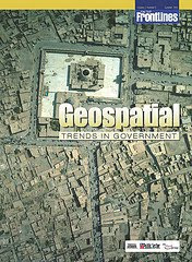
If you’re interested in a detailed look at this growing trend, you should definitely take a look at the most recent On The Frontline publication titled “Geospatial Trends In Government“. In the electronic magazine, Robert Burkhardt, Army Geospatial Information Officer, highlights the four major geospatial trends that are driving the use of Geospatial technologies in government. You can also read about the Army’s Buckey System, which provides high-resolution urban terrain imagery for tactical missions in Iraq and Afghanistan.
No wonder the NGA and Google are moving fast to link up with each other 🙂
![]()

( Thank you. If you enjoyed this article, get free updates by email or RSS – KLJ )
Cloud Computing
- CPUcoin Expands CPU/GPU Power Sharing with Cudo Ventures Enterprise Network Partnership
- CPUcoin Expands CPU/GPU Power Sharing with Cudo Ventures Enterprise Network Partnership
- Route1 Announces Q2 2019 Financial Results
- CPUcoin Expands CPU/GPU Power Sharing with Cudo Ventures Enterprise Network Partnership
- ChannelAdvisor to Present at the D.A. Davidson 18th Annual Technology Conference
Cybersecurity
- Route1 Announces Q2 2019 Financial Results
- FIRST US BANCSHARES, INC. DECLARES CASH DIVIDEND
- Business Continuity Management Planning Solution Market is Expected to Grow ~ US$ 1.6 Bn by the end of 2029 - PMR
- Atos delivers Quantum-Learning-as-a-Service to Xofia to enable artificial intelligence solutions
- New Ares IoT Botnet discovered on Android OS based Set-Top Boxes