
Twitter Feed
Cloud Migration Part 2: Classify your data
In my first post of this series, “Cloud migration part one: An overview,” I provided a high-level summary of how enterprises should migrate applications to the cloud. In this installment,…
Could Budget Sweeps Fix Your Cybersecurity Problem?
A recent roundtable discussion in Washington, DC with Federal IT and Cyber leaders focused on the business drivers, challenges and evolving strategies around cybersecurity in government. After an opening presentation…
Cloud Migration Part 1: An Overview
Cloud Migration Part One: An Overview Business is all about efficiency and effectiveness. In today’s world, however, those twin goals almost always lead to cloud migration. This anecdotal observation…
A Personal Technology for Good Redux: Call for Code
In 2013 I had the opportunity to manage a $2M demonstration of how cloud computing could be used to support natural disasters. In that NCOIC Geospatial Community Cloud (GCC) demonstration,…
A Path to Hybrid Cloud
Cloud computing is now an operational reality across every industry. Organizations that fail to leverage this economic, operational and technology consumption model are merely consigning themselves to irrelevance. The rapid…
Human-Led Collaboration with Machines
When charged with managing large and complex efforts, an overarching project management task is risk assessment. It involves documenting the current situation, comparing it to the past, and understanding the…
Sensomorphic
240 million results are returned in 1.06 seconds (as of May 28, 2018) when you search for cloud computing in a Google search. With that much information available, and that many…
Artificial Intelligence and the Project Manager
Organizations use teams to create wealth, market share, customer service, competitive advantage, and organizational success. Effective teams accomplish their assigned end goals by engaging in collaboration as a joint learning…
Building A Collaborative Team
Recently, Harvard Business Review cited some insightful research into team behavior at 15 multinational companies. It found that although these teams tended to be large, virtual, diverse, and composed of…
Welcome the New Project Manager!
According to CIO.com, the six traits of highly effective project managers are: Be a strategic business partner who can offer higher-level strategic leadership skills, not just technical management skills, provide…
In their February blog post, “BI’s Next Frontier: Geospatial Cloud Computing“, Margot Rudell and Krishna Kumar succinctly described this need:
“Competitive superiority and prosperity require timely interpretation of space and time variables for contextual, condition-based decision making and timely action. Geospatial cockpits with cloud computing capabilities can now integrate the wealth of cloud data like macroeconomic indicators on the web with internal operations information to help define and execute optimal business decisions in real-time.”
In fact, if Washington, DC CTO Bryan Sival has his way, Washington would become the first “Geocity in the Cloud“:
“‘The city is already a heavy supplier of mapping applications, having 26 apps that mash maps up with data on crimes, evacuation routes, school data, emergency facilities, addresses of notaries public, leaf collection, and much more.’
Sivak also wants to provide ways for citizens to update city maps or augment maps with additional information such as the location of park benches and traffic lights. The idea is to take crowdsourcing to a higher level of detail by offering the capability to use this geospatial data to mark not just locations but documents and data relevant to the place.”
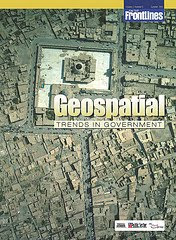
If you’re interested in a detailed look at this growing trend, you should definitely take a look at the most recent On The Frontline publication titled “Geospatial Trends In Government“. In the electronic magazine, Robert Burkhardt, Army Geospatial Information Officer, highlights the four major geospatial trends that are driving the use of Geospatial technologies in government. You can also read about the Army’s Buckey System, which provides high-resolution urban terrain imagery for tactical missions in Iraq and Afghanistan.
No wonder the NGA and Google are moving fast to link up with each other 🙂
![]()

( Thank you. If you enjoyed this article, get free updates by email or RSS – KLJ )
Cloud Computing
- CPUcoin Expands CPU/GPU Power Sharing with Cudo Ventures Enterprise Network Partnership
- CPUcoin Expands CPU/GPU Power Sharing with Cudo Ventures Enterprise Network Partnership
- Route1 Announces Q2 2019 Financial Results
- CPUcoin Expands CPU/GPU Power Sharing with Cudo Ventures Enterprise Network Partnership
- ChannelAdvisor to Present at the D.A. Davidson 18th Annual Technology Conference
Cybersecurity
- Route1 Announces Q2 2019 Financial Results
- FIRST US BANCSHARES, INC. DECLARES CASH DIVIDEND
- Business Continuity Management Planning Solution Market is Expected to Grow ~ US$ 1.6 Bn by the end of 2029 - PMR
- Atos delivers Quantum-Learning-as-a-Service to Xofia to enable artificial intelligence solutions
- New Ares IoT Botnet discovered on Android OS based Set-Top Boxes