
Twitter Feed
So much to blog ….Entry for April 19, 2008
When I started this yesterday, I had a list of about five things I wanted to say on this blog. I then decided on a strategy to list topics as…
Hello World ! – May 18, 2008
I’ve been toying with the idea of doing a blog for about six months now. Initially I didn’t see how any of my contributions to the blogosphere would matter to…
- « Previous
- 1
- …
- 71
- 72
- 73
In their February blog post, “BI’s Next Frontier: Geospatial Cloud Computing“, Margot Rudell and Krishna Kumar succinctly described this need:
“Competitive superiority and prosperity require timely interpretation of space and time variables for contextual, condition-based decision making and timely action. Geospatial cockpits with cloud computing capabilities can now integrate the wealth of cloud data like macroeconomic indicators on the web with internal operations information to help define and execute optimal business decisions in real-time.”
In fact, if Washington, DC CTO Bryan Sival has his way, Washington would become the first “Geocity in the Cloud“:
“‘The city is already a heavy supplier of mapping applications, having 26 apps that mash maps up with data on crimes, evacuation routes, school data, emergency facilities, addresses of notaries public, leaf collection, and much more.’
Sivak also wants to provide ways for citizens to update city maps or augment maps with additional information such as the location of park benches and traffic lights. The idea is to take crowdsourcing to a higher level of detail by offering the capability to use this geospatial data to mark not just locations but documents and data relevant to the place.”
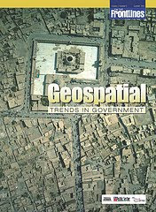
If you’re interested in a detailed look at this growing trend, you should definitely take a look at the most recent On The Frontline publication titled “Geospatial Trends In Government“. In the electronic magazine, Robert Burkhardt, Army Geospatial Information Officer, highlights the four major geospatial trends that are driving the use of Geospatial technologies in government. You can also read about the Army’s Buckey System, which provides high-resolution urban terrain imagery for tactical missions in Iraq and Afghanistan.
No wonder the NGA and Google are moving fast to link up with each other 🙂
![]()

( Thank you. If you enjoyed this article, get free updates by email or RSS – KLJ )
Cloud Computing
- CPUcoin Expands CPU/GPU Power Sharing with Cudo Ventures Enterprise Network Partnership
- CPUcoin Expands CPU/GPU Power Sharing with Cudo Ventures Enterprise Network Partnership
- Route1 Announces Q2 2019 Financial Results
- CPUcoin Expands CPU/GPU Power Sharing with Cudo Ventures Enterprise Network Partnership
- ChannelAdvisor to Present at the D.A. Davidson 18th Annual Technology Conference
Cybersecurity
- Route1 Announces Q2 2019 Financial Results
- FIRST US BANCSHARES, INC. DECLARES CASH DIVIDEND
- Business Continuity Management Planning Solution Market is Expected to Grow ~ US$ 1.6 Bn by the end of 2029 - PMR
- Atos delivers Quantum-Learning-as-a-Service to Xofia to enable artificial intelligence solutions
- New Ares IoT Botnet discovered on Android OS based Set-Top Boxes